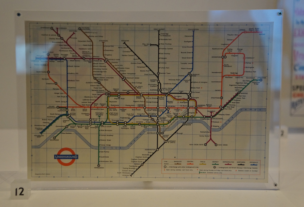
1964 Tube map. The history of this map is really interesting and is another milestone for the city transportation systems around the world invented in London. As London's early transport system was operated by a variety of independent companies, there were no complete maps of the network. In 1907, The Evening News commissioned a pocket map, The Evening News London "Tube Map". It was the first map to show all of the lines with equal weight being given to each line, and it was the first map to use a different colour for each line. Another early combined map was published in 1908 by the Underground Electric Railways Company of London (UERL) in conjunction with four other underground railway companies that used the "Underground" brand as part of a common advertising factor. A geographical map presented restrictions since for sufficient clarity of detail in the crowded central area of the map required the extremities of the District and Metropolitan lines to be omitted and so a full network diagram was not provided. (previous | next | back to album | 2020:02:12 15:13:51 | 59% of an album)